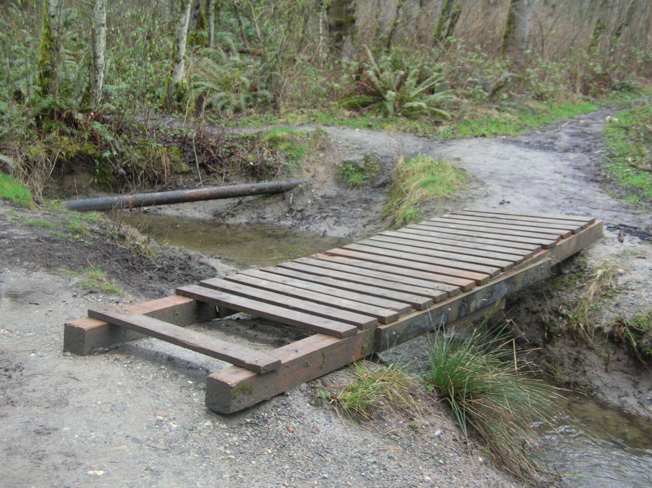
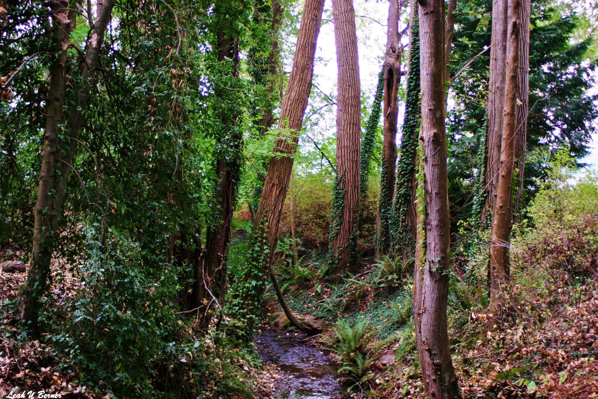
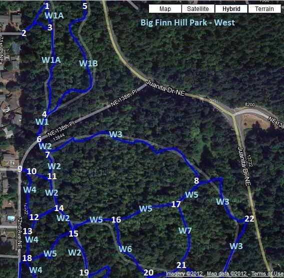
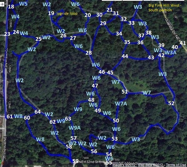
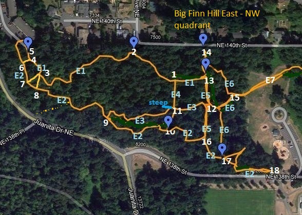
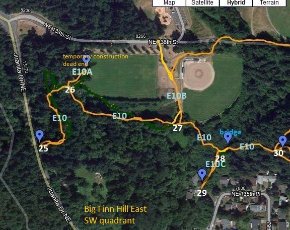
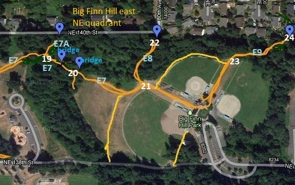
To support ongoing trail planning efforts within Big Finn Hill Park, several volunteers have been inventorying and mapping the existing trails throughout the park. Links to the draft maps are found below. Members of the stewardship committee intend to use these maps to enhance accuracy of communication with a wider Big Finn Hill Parks trail user community.
Items to keep in mind when viewing the maps:
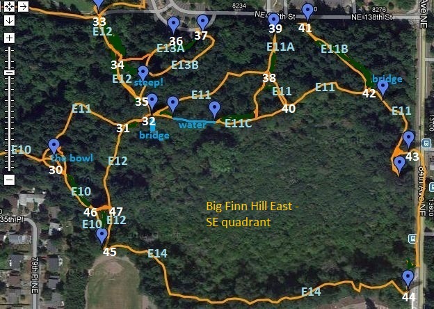
- These are drafts for creating a mode of communication only, and are not a permanent number and/or naming system.
- Intersections have been numbered and some trails named.
- The trail naming convention: W-(number) is west of Juanita. E-(number) is east of Juanita. Trail labels are in pale blue.
- Intersections are a simple number. The intersection numbers start at #1 on the west and on the east sides. On these maps the numbers are white.
- Maps from the west portion of the park also have grey lines. Those are the Google map defaults for trails in the park.
East of Juanita Drive – Northwest
East of Juanita Drive – Southwest
East of Juanita Drive – Northeast
East of Juanita Drive – Southeast

