Finn Hill Maps
Finn Hill Parcel Map pdf
Finn Hill Southeast jpeg
Finn Hill Expansion Opportunity pdf
Finn Hill Satellite View pdf
The City of Kirkland has an Enterprise Geographic Information System (GIS) Program. The city GIS program is committed to providing access to its data resources, for external users as well as city staff. Please contact the GIS Administrator for more details on the city’s wealth of spatial data sets and diverse GIS initiatives. Selected standard map products currently available on the Kirkland.wa.gov site include:
City of Kirkland Events Map
City of Kirkland Base Map
City of Kirkland Neighborhood Areas
City of Kirkland Land Use Map
City of Kirkland Annexation Area
City of Kirkland Sensitive Areas
City of Kirkland Snow Routes
Solid Waste Service Collection Day
Water & Sewer Service Areas
City of Kirkland Zoning Map
City of Kirkland Walking Routes
City of Kirkland Flow Control Map
City of Kirkland SMA Designations Map
An old map of O.O.Denny Park, when it was a summer camp for Seattle kids.
Map of Juanita Heights Park Restoration Management Units prepared by EarthCorps Jan 25, 2013
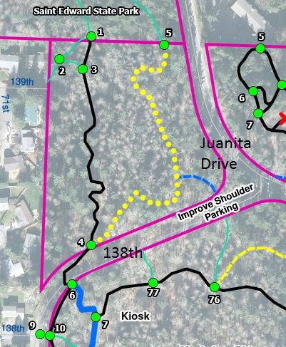
Map of Big Finn Hill Park Northwest Section
Map of the Madrona Grove in Big Finn Hill Park
Map of Juanita Woodlands Park Aerial Photo
Map of Parcel purchased in 2013 located on Simonds Road