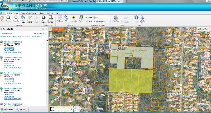
New Public Map Portal Queries Many Data Layers
There is a new City of Kirkland map portal. Quoted from the site….”Kirkland Maps is a public mapping portal that allows the community to access, navigate to, and query selected data layers from the citywide GIS database and other sources. Using your computer, you can easily access the city’s property information, permitting information; zoning and land use information, utility information, topographic information, and sensitive areas information. You can also create a property report, apply for permits, pay utility bills, and print out maps.” Explore this map portal and submit interesting mapped information you have discovered about Finn Hill. As...
Read More